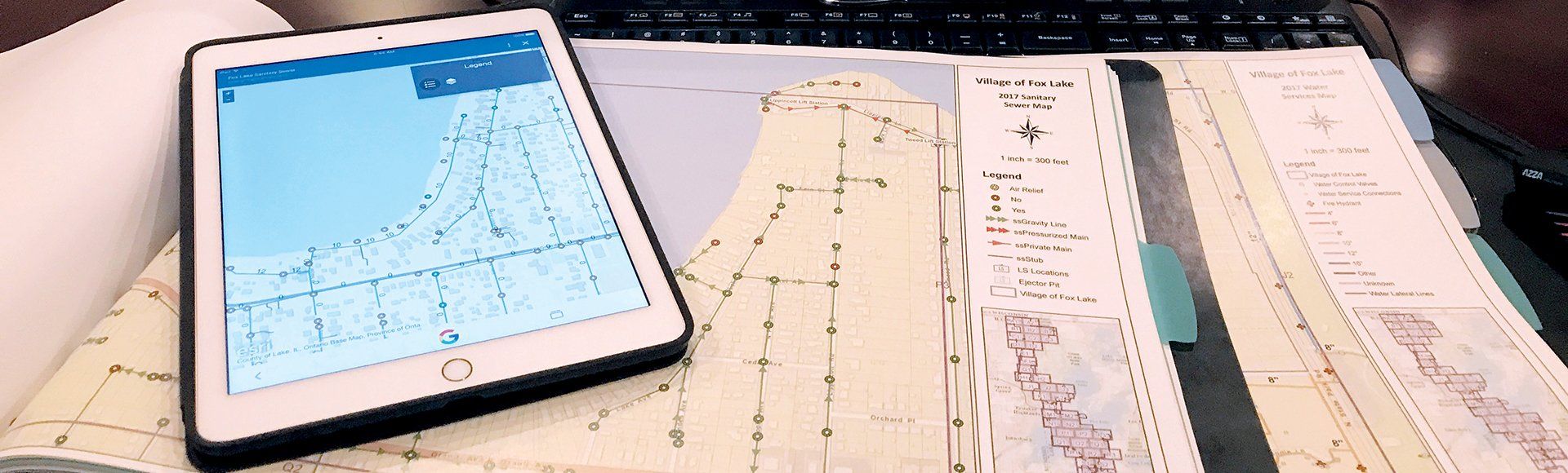
GEOGRAPHICAL INFORMATION SYSTEMS (GIS)
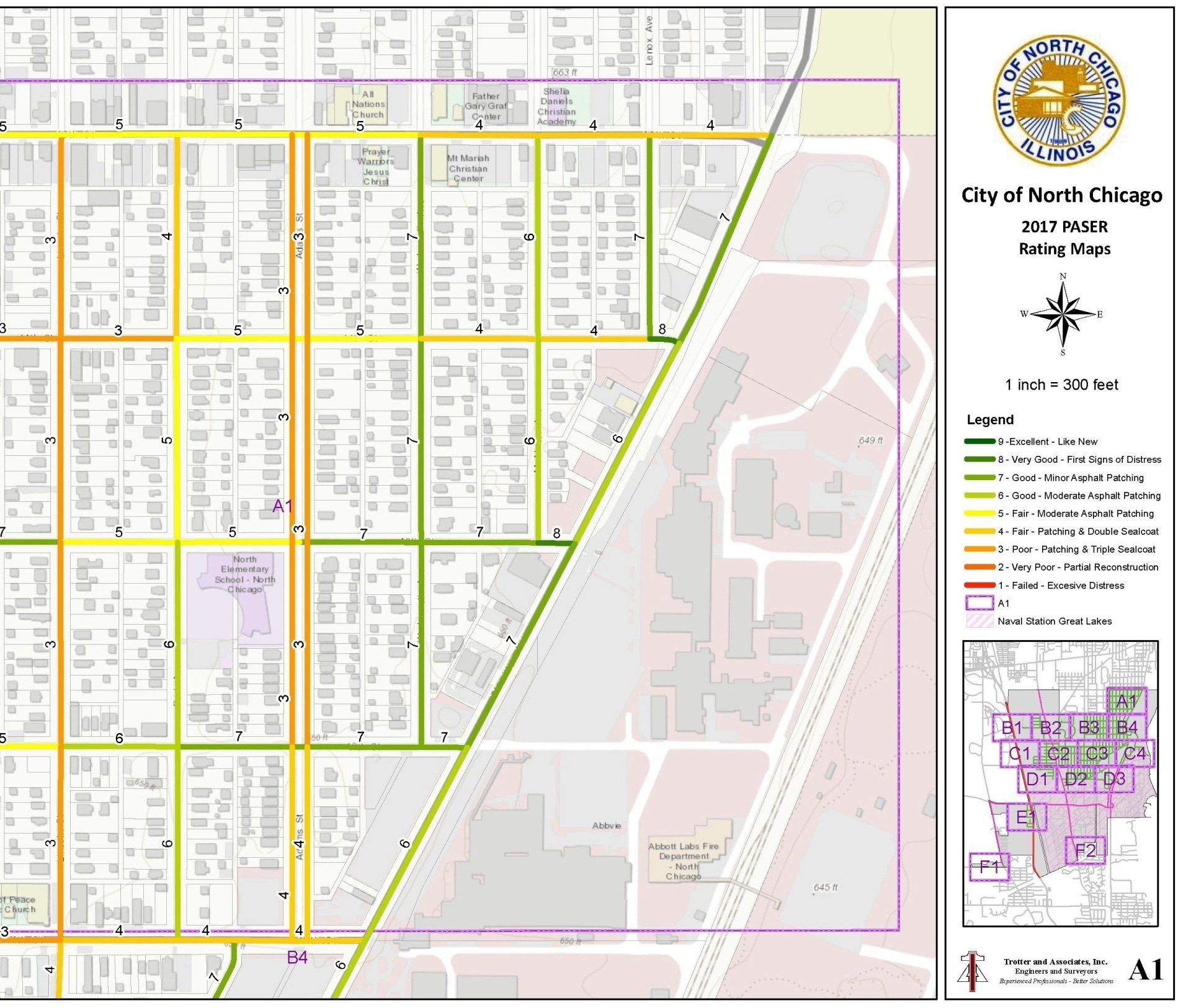
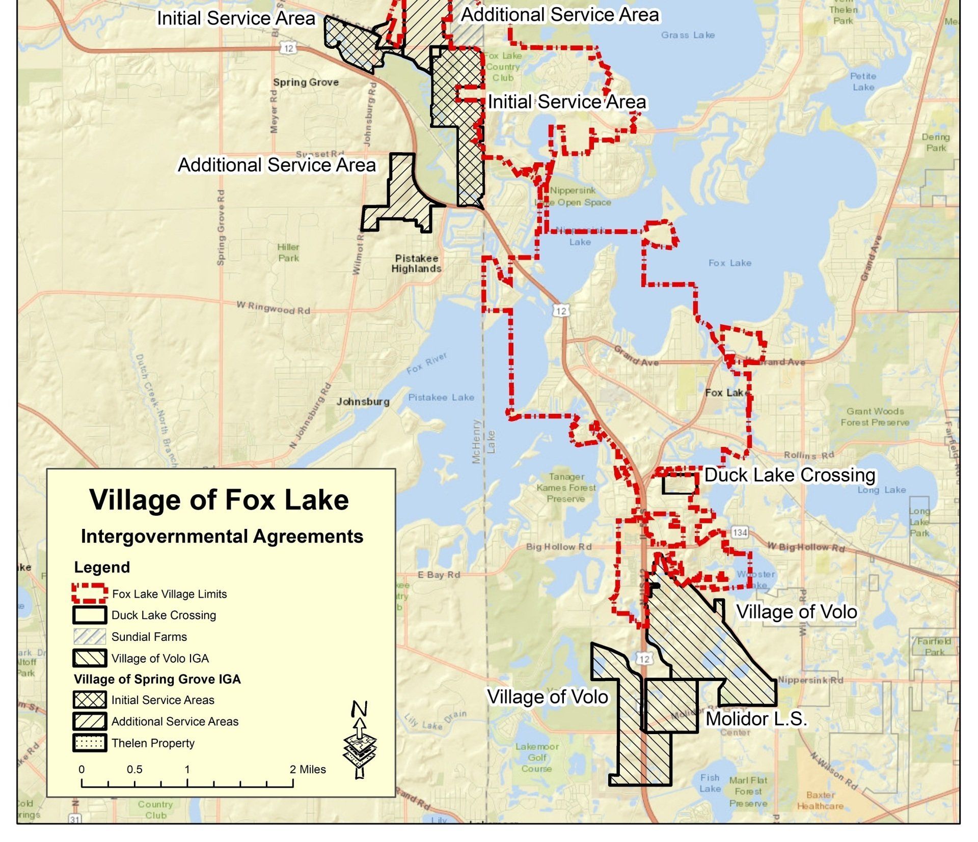
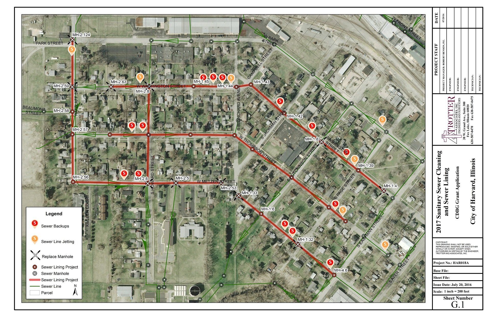
Trotter and Associates, Inc. provides multiple services in the GIS field including infrastructure mapping (water, sewer, storm sewer, roads, etc.); utility master planning; parcel, natural resource and boundary mapping; asset management; geodatabase development; water and sanitary sewer modeling; road inventory, condition and PASER analysis; and hydrologic and hydraulic analysis.
TAI has been assisting local governments in managing their infrastructures for over 15 years and our staff has served as the appointed municipal engineer in several communities.
We understand that each community is different, with different priorities, needs and resources. TAI’s excellence in GIS services comes from our understanding that GIS is not a one-size-fits-all solution. Providing information in multiple formats so that everyone across the organization will have the ability to review and make decisions from the same updated data. We strive to understand each community’s short- and long-term goals and craft community-specific GIS solutions to help them achieve those goals.
Trotter and Associates, Inc. utilizes Esri’s ArcGIS Desktop and its extensions to develop a robust geodatabase that can be used for mapping, asset management, data analysis, budget review and analysis and general municipal management. GIS software is used to review, process, and extract data needed to perform hydrologic/hydraulic modeling; review and model pipe infrastructure networks (storm, sanitary, water main); and create professional map exhibits which accurately depict the project information at a scale that allows the client to understand the project’s relationship to the surrounding landscape.
A fundamental component of Trotter and Associates, Inc.’s strategic plan is reinvestment into the firm’s capabilities. Looking to the future, TAI has expanded its GIS Department with the addition of a GIS manager, a GIS technician and an engineer certified in GIS. As with all of TAI’s team members, the GIS team was hand-picked by Scott Trotter for their skill set, fit with corporate culture, and dedication to the success of TAI’s clients.
GET IN TOUCH
HAVE AN ENGINEERING PROBLEM THAT YOU'D LIKE OUR HELP WITH?
RELATED PROJECTS